The series of maps that follow revolve around energy usage in the world. I've made a list of countries, based upon their total Btu consumption, to see where most of our energy is being consumed.

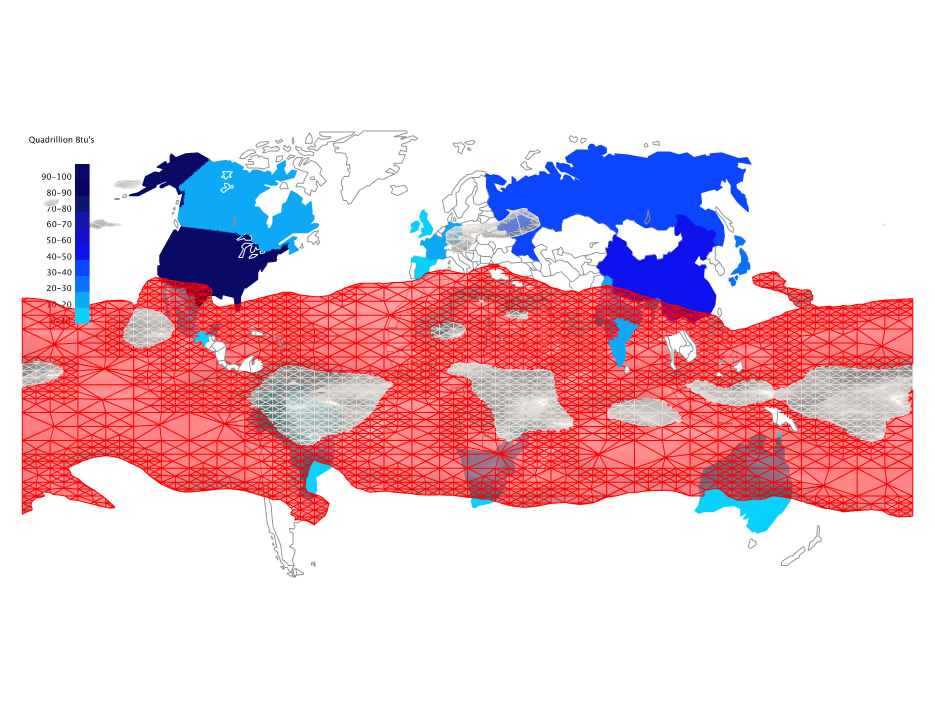
After overlaying the heat absorption surface over the Btu consumption map, it showed me that the areas most affected by solar energy lie in areas where not much energy is being used. I propose that energy should be gathered using mega photovoltaic farms in areas of high solar heat gain, then tranfer the energy via microwaves or radio waves to areas in the world that have more need of the energy.

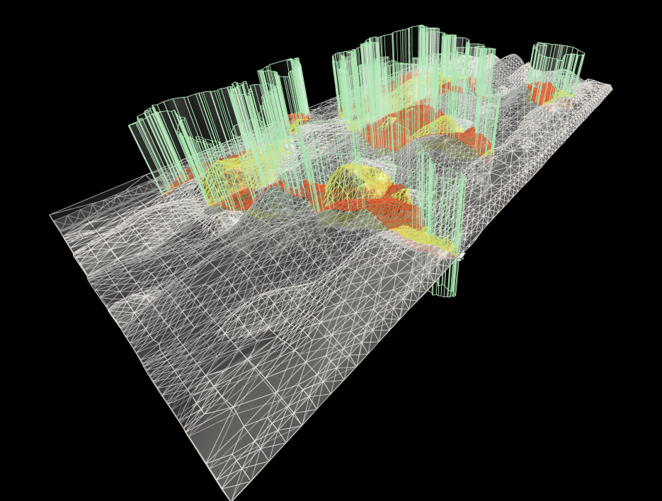
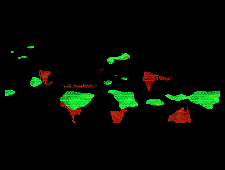
The image below shows new land formations from the intersection of aborbed and irradiated solar energy, creating what I call Transmission Colonies. These new archipelagos serve the purpose of collected energy from the photovoltaic farms and transmitting it around the world.
The other land formations are formed using the countries of high Btu consumption then trimming the heat absorption surface at their intersections, creating Heat Archipelagos. These archipelagos are where the photovoltaic farms will be located, gathering the suns energy and converting it into usable electricity, then fed to the Transmission Colonies.

Final solar map construction
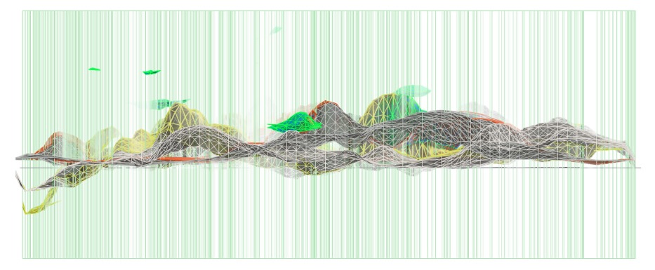
(above) Section of final map
The following maps are created for the "new world" using the parameters from the newly developed archipelagos. The maps consist of analyses on climatic conditions, population densities, and typologies, and nightcaps of the world.
(below) new world map showing climatic conditions in location of archipelagos
The climate map indicates the most of the areas revealed in the new world are predominately arid with scattered tropical wetlands. Since the surface conditions vary, this will help me to respond structurally.

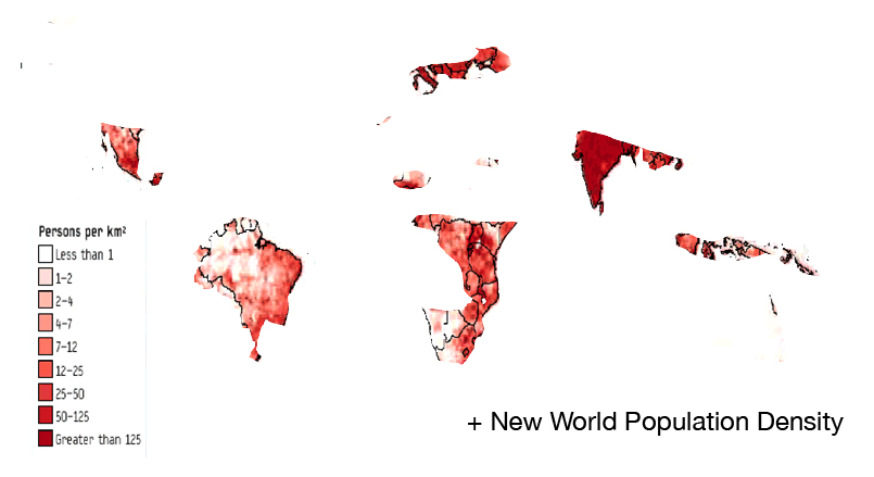
Image below showing lights at night
The illumination at night shows us specific densities in various countries of energy being used at night. Although China is the second (behind the US) in energy use, it seems that the night time is not as active as Spain and Germany, for instance. This in turn would lead me to suggest that the energy distribution has variability from day to night.


3 comments:
trevor,
Transmission Colonies and Heat Archipelagos are certainly interesting territories that you have uncovered. perhaps before someone comments on your presentation, you could be more explicit about your images and what they tell us. for example, you show light at night in an image, but you don't tell us the significance of that image. the same could be said for other images. the graphic, data and language is compelling, but i think a first time viewer would have a little trouble clearly understanding some of it. spend some time adding image captions and your interpretation of them.
link: http://bldgblog.blogspot.com/2006/11/sun-cancellation-cloud.html
HI Trevor:
I'm sorry I'm commenting so late, I tried to post twice before but I think blogger was down and / or we had a slow connection.
At any rate, I understand your drawings and concept. I think it is quite clear.
I think it's a good idea to make solar nations that collect energy, however I don't think you can microwave electricity around. Perhaps your transmission colonies could not only collect but store energy, like batteries, and the colony itself moves to redistribute electricity to other nations that use excessive amounts of energy. Or you could propose moving some of the industry in places like the USA and China (or other places that you have identified in your mapping) that use excessive amounts of power to the transmission colony?
Do your heat archipeligos follow the path of the sun? What happens at night? Currently (as you know) the panels in the solar array track the sun, but could your entire archipelago follow the sun? Does that mean it has an annual cycle of movement?
Post a Comment